6.1 Ethnicity, Place, and Territory
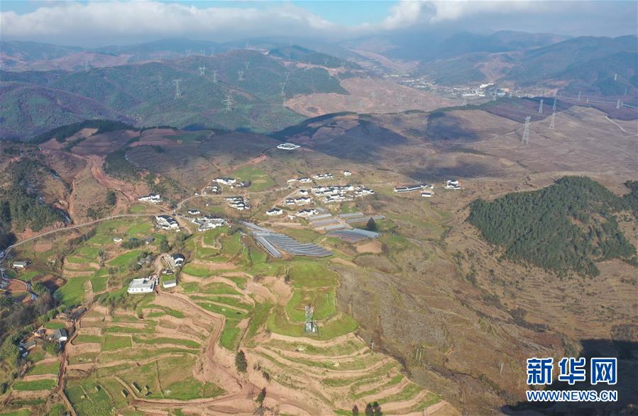
Huopu Village, Liangshan Yi Autonomous Prefecture, Sichuan. Source.
Today
- Discuss how China’s borderlands and frontier spaces were central to 20th century nation building.
- Discuss ethnic minority classification and territorialization in China
- Expand analytical framework on identity and space to include ethnic minority identity.
Reading
Sutton (2024)
Key concepts
- territory
- territorialization
- state territoriality
Reading Response
Clear your desks, except for a blue or black pen (no colors, no markers, no pencils). Take a sheet of paper.
Discussion groups – Weeks 6 to 7
| Class | 1 | 2 |
|---|---|---|
| 1.1 | Yijun S. | Veronica V. |
| 2.1 | James S. | Julia G. |
| 3.1 | Lucy L. | Zifei W. |
| 4.1 | Yiran S. | Vera B. |
Concept mapping Joniak-Lüthi, Yang and Sutton
Concept maps are a graphic representation of the conceptual structure of a work, a map of the relationship between concepts in your own mind. This is a tool for thinking, for externalizing your understanding of conceptual relationships and for expanding or revising that understanding.
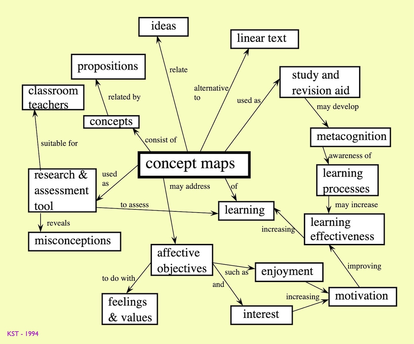
Three elements are essential: concepts (ideas, evidence, etc.), links between concepts, and labels that explain the linked relationships between concepts. You should be able to read paths through your concept map almost as grammatical sentences, thought the grammar here has more to do with relational patterns of thinking.
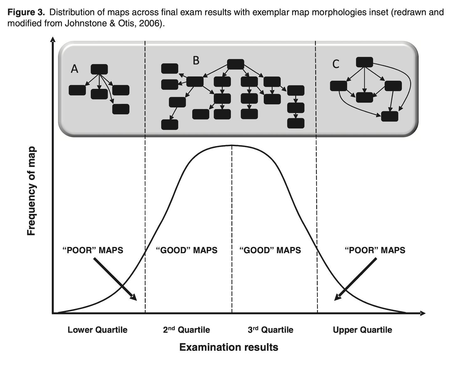
Generally, the more you can focus on key concepts and links (quality) – rather than simply more of them (quantity) – the more effective concept maps are for representing and visualizing your thinking.
Concept mapping for synthesis
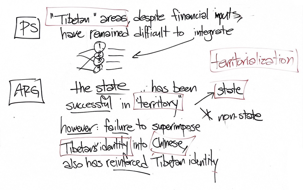
With your group develop an answer to the question, How is ethnicity in China spatial?, in a concept map. Focus first on Sutton (2024).
Incorporate Joniak-Lüthi (2013) and Yang (2009) (and optionally Lawler (2009)) into your concept map by building relationships between the most useful and relevant concepts with a single goal in mind, generating a coherent answer to the question.
Wrap up
- China Gazetteer Annotated Bibliography due tomorrow (Friday, Oct 9)
- weekend workshop: The Plants We Pass On - Creative Story Archiving Around Plants in Sanlin 10:00 a.m. to 4:00 p.m., Saturday, October 10 2026
- “As the last remaining section of historic Sanlin Old Street (三林老街) undergoes demolition, this workshop series organized by CEL x IMA will gather oral histories and preserve a snapshot of what will soon be gone: everyday encounters, plants and the practices of tending them, the people, and the relationships between them. Along the way, we will explore different ways of documenting and preserving stories, from field research and interviews to digital preservation, zine making, and alternative mapping.”
For next class
Focus on Denton (2013) for the Reading Response, especially the argument about red tourism and national landscape. Wang (2019) provides a supporting case of green tourism, but you can skim that.