9.2 Discussion
Cartography and Imagined Nation

Changbaishan (Wanda Resorts). Source.
Today
- Explore the role of maps and cartography in the 20th century history of national territorialization.
- Analyze the differences between thinking about territory geopolitically and in terms of the geobody.
Reading
Callahan (2009)
Key concepts
- imperial vs. sovereign territory
- national geo-body
Synthesis reports
- Lucy L.
The national geobody
- geobody
- the felt, imagined, and visualized territory of the nation
- territorialization of the geobody
- social, cultural and political discourses and practices go into making territory something identifiable to both a state movement and to the people it seeks to govern; a way of talking about territory that gets away from the simple correspondence of map to land, and borders to a space of political control
The state seeks to match territorial and cultural boundaries not only through military coercion and fiscal regulation but also through a management of identity practices. (Callahan p.144)
As state-building projects of the early 20th century envisioned different nations (Fitzgerald’s “nationless state” idea), so too did they envision a national territory, both in terms of modern geopolitical boundaries and in terms of a cartographic imagination of past traumas and desired futures.
The borders of the Chinese geobody are neither obvious nor fixed; they are contingent on historical events and are framed by cartographic conventions. China’s borders are the product of debate and struggle as the country has gone through major transitions first from an empire to a nation-state in the early twentieth century, and now from an isolated revisionist state to an engaged superpower at the turn of the twenty-first century. (Callahan p.145)
…these cartographic strategies produce China’s national geobody by linking imperial domain with sovereign territory. (161)
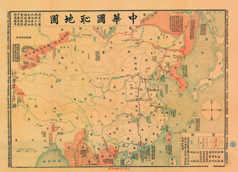
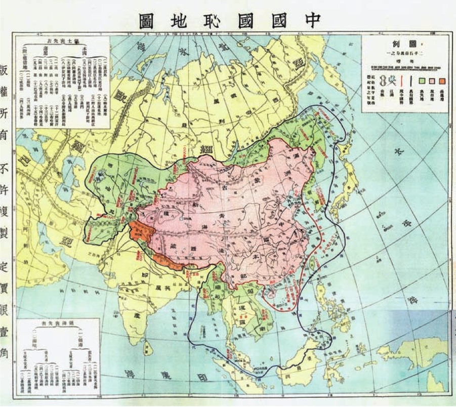
Cartography of national humiliation
Just as new words like guojia and Zhonghua minzu were created to describe China as a post-imperial nation, new cartographies also helped both define and set the future course for nation-building projects.
These maps of China’s National Humiliation 中国国耻地图 were produced between 1912 and 1937, and reappeared after the Tian’anmen protests in 1989 as part of a Patriotic Education campaign.
These maps served as markers of loss, both in terms of the loss of borderlands in China’s transition to modern state and in terms of a national idea about national humiliation. These ideas are powerful no matter which national movement we consider, whether Chinese citizen, the (Han) Chinese race, or the appropriate Chinese economic class envisioned by the CCP.
Synthesizing discussion
Spend 10 minutes in your group discussing your overall impressions of Callahan’s argument about cartography and the geobody. Focus on some of the example maps that capture your interest, and bring in the discussion we had last week on state and nation (Fitzgerald 1995).
Wrap up
- Course changes posted tomorrow, including readings